WITH THE RING OF THE GREAT WAR
The Valcanale and other valleys in the far northeastern part of the Friuli Venezia Giulia Region, now Italian, were during the years of World War I on opposite sides. During the conflict, the armies of the Kingdom of Italy and the Austro-Hungarian Empire transformed the territory, scattering it with buildings that later fell into disuse but also with roads, mule tracks and paths still used today. Buildings and paths that were sometimes only a few hundred meters apart and were sometimes separated by wide valleys.
But where did the front lines of the two adversaries really pass and where was the "no man's land" that separated them?
Inevitable to ask this question, as soon as one encounters any of the many war remains at high or low altitudes, because today no trace seems to remain of those imaginary but bloody lines...
The World War I Ring, interweaving today's alpine trails with the Alpe Adria Radweg bike path, will allow you to follow as closely as possible the front lines of the two armies and cross the once contested territories in peace.
Choosing a route according to your interests and abilities, you can decide to ride the cycle path and discover the valley floor quartering or visit the forts, redoubts and mule tracks on foot at high altitude. Along this "high route," the four refuges are the welcoming places where you can also "stop by" to ask and receive information about the places and memories that the War has imprinted on the surrounding environment.
THE PATH OF THE SOLDIERS
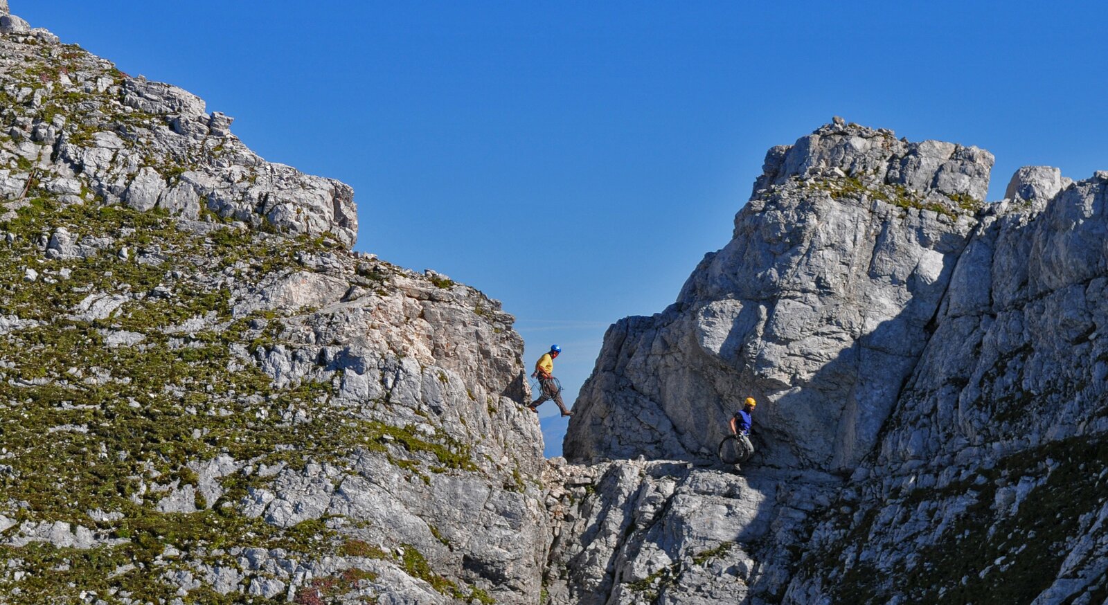
At the outbreak of the Great War, part of the border between the Kingdom of Italy and the Austro-Hungarian Empire descended along the Pontebbana Valley to climb into the Western Julian Alps as far as the Jôf di Montasio and then up to the Canin ridge.
The soaring peaks of the Julian Alps were difficult for troops to conquer: the greatest difficulties the armies had to face on the Alpine front were related to the imperviousness of the terrain and climatic adversity. The elevation of the mountain ranges therefore made it essential to build, as the conflict progressed, a dense network of roads, mule tracks, paths, cable cars and shelter posts. Up there, surrounded by breathtaking views, you can visit the tunnels, caves, trenches and precarious shelters of the combatants, accompanied by the timeless echo of Alpine songs.
The routes suggested below were published in the guidebook "On the Trails of the Great War" by Davide Tonazzi, a military history enthusiast and historical guide: Cime Castrein, Monte Cregnedul, Testa di Malborghetto, Monte Nebria, Monte Cit, Scalzer/Bruca, Jof di Miezegnot from Sella Sompdogna, Due Pizzi, Piccolo Nabois - Sella Nobois - Grande Nabois, Jof di Somdogna, Cima Mughi/Passo Predil, Cima Pesce/Rifucio Corsi/Malga Grantagar, Cuel della Bareta, Monte Robon/Cima Mogenza, Ponte Poviz, Forcel Cuel Tarond, Sella Bieliga, Piccolo Jof di Miezegnot.
The mountains always hide pitfalls, so equip yourself appropriately with boots, rain jacket and spare parts, a topographic map, as well as something to drink and eat.
Also, since caves and tunnels are frequently encountered along the trails described, it is a good idea to have a flashlight available.
Finally, if you go alone, don't forget to leave said where you are headed!
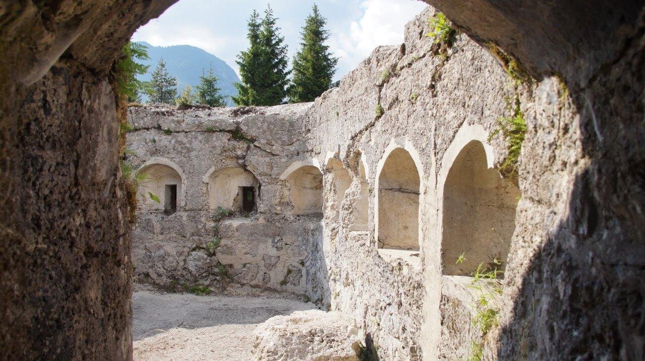
THE CANNON ROAD
Opposing armies used the valley floor routes to store goods, treat the wounded, and transport food and ammunition to the front lines, building in the most strategically or logistically important areas infirmaries, warehouses, stables, depots, forts, and battery emplacements, which were later joined by museums, charnel houses, cemeteries, and funerary monuments. Today, the Alpe Adria Radweg bicycle route and the dense network of bicycle and pedestrian paths through the Valcanale valley make it easy to visit the remains of these Italian and Austro-Hungarian buildings, distributed among the municipalities of Tarvisio, Malborghetto, Pontebba, Chiusaforte, and Resia.
These artifacts allow for a deeper understanding and reliving of the experiences of soldiers and civilians during the Great War, a conflict, then, without terms of comparison:
- Route of "Plans"
- Redoubt of the pond and the Museum of Territory and the Great War in Dogna
- Reschen military cemetery
- Sella Predil Battery, the Military Charnel House and the Historical Military Museum of the Julian Alps in Cave del Predil.
Information on the regulation of the sale, trade, display or donation of historical and archaeological artefacts
In the event of accidental discovery of historical and archaeological artefacts, with particular reference to war artefacts dating back to the Great War, they may not be collected, sold, traded, exhibited or donated unless reported to the competent superintendency and authorised by the competent Ministry, in accordance with regional, national and international laws.